Garmin GPSMAP 66i gets InReach functionality
Garmin’s flagship handheld navigator meets global communication with the new GPSMAP® 66i.
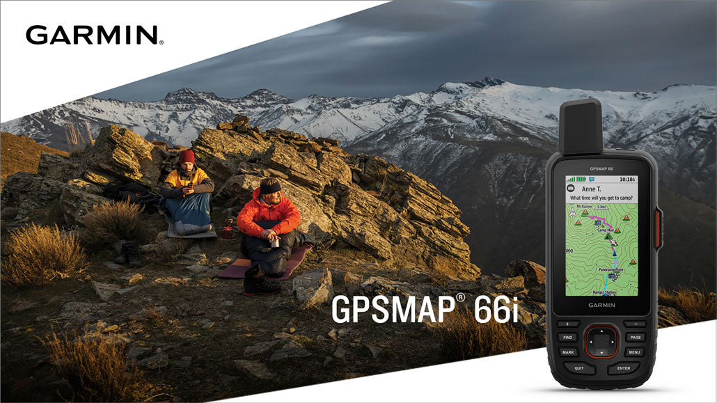
Garmin® International, Inc. recently announced the GPSMAP 66i, the highly anticipated handheld device combining Garmin’s premium GPS navigation with inReach® satellite communication technology. Stay in touch with friends and family using the GPSMAP 66i’s two-way messaging and 24/7 SOS function. Explore confidently with its large 3-inch sunlight-readable colour display, preloaded TopoActive maps, and direct-to-device wireless BirdsEye Satellite Imagery.

“We’ve listened to our customers and the GPSMAP 66i gives them exactly what they’ve asked for — combining our industry-leading GPSMAP 66 navigation with inReach satellite communication,” said Dan Bartel, Garmin vice president of global consumer sales. “Adding inReach technology to our GPSMAP 66 series will revolutionise outdoor exploration.”
The 66i offers two-way messaging and location tracking, allowing adventurers to stay connected even when far off the grid. Using the worldwide coverage of the Iridium® satellite network, the GPSMAP 66i enables communication with any cellphone number, email address, or other inReach device, while GPS tracks and shares progress throughout the journey. When LiveTrack is enabled, family and friends can follow the user’s location via MapShare.
The GPSMAP 66i also lets users trigger an SOS to the GEOS 24/7 emergency response team for real-time support in case of emergency. GEOS — a global leader in emergency response and monitoring — not only coordinates rescue services but also communicates directly with the user and designated contacts until the situation is resolved. Garmin offers a range of flexible subscription plans to match both regular adventurers and occasional explorers.

With direct-to-device Wi-Fi® downloads of BirdsEye Satellite Imagery, users can view high-resolution, photo-realistic landscapes of their routes — ideal for scouting trailheads, campsites, and natural landmarks. The GPSMAP 66i also comes preloaded with routable topographic maps for detailed navigation, showing coastlines, rivers, summits, contours, and key geographic features.
Ruggedly built to U.S. military standard 810G for shock, vibration, and water resistance, the GPSMAP 66i is ready for any adventure — even long expeditions in harsh conditions. Battery life lasts up to 35 hours with 10-minute tracking enabled, and up to 200 hours in Expedition Mode with 30-minute tracking intervals. Support for GPS and Galileo, combined with an altimeter, barometer, and compass, ensures confident navigation anywhere.

Compatible with the Garmin Explore™ app, users can access additional tools for trip planning, mapping, and data sharing. This connection allows typing inReach messages from a smartphone and syncing contacts easily. The GPSMAP 66i also integrates with Garmin wearables — including the fēnix 5 Plus, Instinct, Tactix Charlie, and MARQ Expedition — for viewing messages, replying, or initiating an SOS directly from the wrist.
The Garmin GPSMAP 66i became available in the U.S. in June 2019, with a suggested retail price of $599.99.