Amatola Hiking Trail
The Amatola Hiking Trail
Beauty: 4 (of 5)
Difficulty (fitness): 9–10/10 (Extremely difficult due to long days and big ascents and descents, i.e. you need to be fit and strong)
Technical rating of trail: Standard trail walking and minor river crossings.
Duration: 6 Days, 100 km
The Amatola Trail (6 days, 100 km) is marketed as “The Toughest Hike in South Africa,” and it lives up to the title. There may be harder wilderness hikes around, but as far as hutted hiking trails go, the Amatola Trail is as challenging as they come.
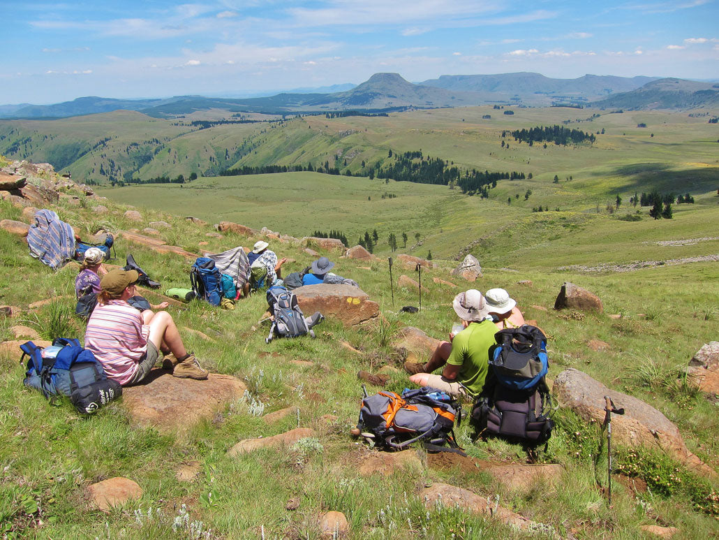
The trail starts at Maden Dam near King William’s Town and traverses the Hogsback Mountains all the way into the Tolkienesque village of Hogsback itself. Its main features are the abundance of waterfalls and mountain pools, as well as the ancient, indigenous rainforest that makes up more than half the route.
Day 1: Maden Dam – Gwiligwili Hut (11 or 15.3 km)

Do not underestimate the first day, even if you choose the 11 km variation, as you will ascend 700 m. Give yourself enough time to start slow. You will notice what looks like fresh dog poo everywhere — don’t panic, it’s digested soil from giant earthworms that can grow up to a metre in length.

Gwiligwili Hut is perched high up on a hillside with beautiful views of the surrounding area. There’s also a separate braai area, making for a very social first night.

Day 2: Gwiligwili Hut – Dontsa Hut (18 or 19.6 km)

Day 2 is the longest section of the hike, and most of it is spent traversing ancient, dense forest where sunlight struggles to pierce the thick canopy. It’s a feast for the senses as one wanders through a dreamlike sea of green, the hum of cicadas broken by the occasional call of a Knysna lourie.
 Sea of Green.
Once you’ve settled in at Dontsa Hut, the cares and stresses of city life seem a million miles away as the peace of the mountains starts to sink in.
Day 3: Dontsa Hut – Cata Hut (16.8 or 19 km)
It’s important to make an early start on Day 3, as it’s another long day with a serious sting in the tail.

As you leave the forest behind and ascend to the plateau, you’re treated to an entirely new landscape of macchia grassland and a myriad of wildflowers.
 Flowers of the Amatola.
You have the option of taking the high road and summiting Doornkop, or staying low and traversing through the Hovald forest. If it’s a clear day, the views from Doornkop are about as good as they get.
 Doornkop.
The brutal final ascent to Cata Hut is made bearable by the magnificent display of waterfalls through the aptly named Waterfall Forest. The Amatola Trail is sometimes referred to as the “waterfall trail,” and this day leaves no doubt as to why.
 Waterfall Forest.
 Cata Hut — a very welcome sight at the end of Day 3.
Day 4: Cata Hut – Mnyameni Hut (13.5 km)
Day 4 is a great opportunity to take things a little slower, as it’s shorter and easier than the other days. There are many viewpoints that make for great snack spots, as well as plenty of pools and waterfalls to enjoy.

After the initial ascent from Cata Hut, you start to descend a rock-filled valley. These stones seem to contain a large amount of iron, ringing like steel when tapped with trekking poles. There’s even what looks like a burn mark, as if struck by lightning — not the place to linger in a thunderstorm!
 Lightning strike burn mark?
Good thing we made it to the hut in time, as that night we were treated to a magnificent New Year’s Eve lightning display. We had arranged a food drop through Amatola Trails, so that night we enjoyed steak and red wine while nature put on an unforgettable show.
 Storm clouds rolling in.
The next morning, we woke to a magnificent sunrise.

Day 5: Mnyameni Hut – Zingcuka Hut (18.2 km)
Get an early start again, not just because of the distance but because of the many swimming spots along the way. By now, our bodies were really starting to feel the hike, and the regular stops and refreshing swims made this day a treat.

Zingcuka Hut is a beautiful wooden hut with comfortable beds, a donkey boiler to heat water, and tables and chairs to sit around till late, watching the stars and soaking in your last night on the trail.

Day 6: Zingcuka Hut – Tyume River (15 km)
The final day involves a steep 800 m climb up to the main Hogsback Peak before descending into the Tyume River basin toward the end of the trail.

 One last waterfall for good measure.
There’s a shortcut along a jeep track if you can’t face another long day, but it’s quite a satisfying feeling walking under the official signage at the end of the trail. From here, it’s a 3 km walk into Hogsback along the road.

Conclusion
What makes this trail truly special is its diversity. The forests, mountains, waterfalls, and flora combine to make it unique among South African trails. It’s one of the country’s great hikes and a must-do for any experienced hiker.
That said, it’s physically very demanding, so proper training is advisable. Attempting this hike while unfit will spoil the experience — many groups don’t finish due to its challenges. Weather can change rapidly, from hot and humid to freezing cold with rain or even snow, so go prepared. If you’re a novice, ensure there’s an experienced hiker in your group.
We did the hike over New Year’s. The weather was hot and humid but not unbearable — perfect for swimming — though we did experience rain and one thunderstorm at night.
How to Book
Department of Agriculture, Forestry and Fisheries
Tel: 043 642 2571
Email: Amatolhk@daff.gov.za
Away with the Fairies
Tel: 045 962 1031
Email: hogsback1@gmail.com
Use our Multi-day Hiking Checklist to make sure you have everything you need.