Cape Town Skyline Traverse
Beauty: 5/5
Difficulty: 10/10 (25km long, total ascent of 2630m)
Technicality: Extremely technical, featuring steep, exposed scrambling, difficult route finding, and abseiling.
Disclaimer:
This route includes multiple sections of very exposed scrambling and abseiling where a mistake could result in serious injury or death. It should only be attempted by highly experienced hikers who are comfortable with heights, technical climbing, and abseiling. Extreme caution is required.
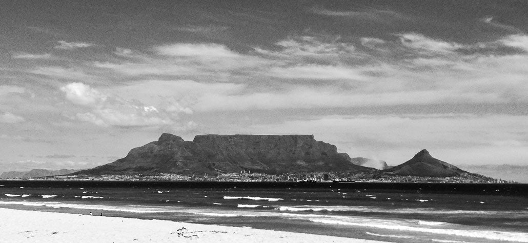
On 18 September 2017, Hilton Davies and Don Hartley completed the iconic Cape Town Skyline Traverse, starting at Bantry Bay and finishing at the Liesbeeck River in Rosebank. A few weeks later, I had the privilege of doing the same route with Hilton — but in reverse, from east to west — starting in Rosebank and ending in Bantry Bay.

Hilton, better known for his daring rock-climbing first ascents, envisioned a traverse across the Cape Town skyline that combined endurance and exposure. The East-West variation we attempted followed the sun’s path to maximise daylight and omitted strict climbing pitches, though scrambling still featured prominently.
We set off at 06:20 from Alma Road, where it crosses the Liesbeeck River in Rosebank. Spirits were high, legs were fresh, and we had a long day ahead.

It was a perfect morning, the first rays of sunlight painting the mountain in pink and gold. By 07:30, it was already about 26°C, so we took it steady and kept well hydrated.

The route up from Rosebank passes several historic landmarks — Rosebank Methodist Church, Welgelegen, Mostert’s Mill, Rhodes Memorial, and the King’s Blockhouse high on Devil’s Peak.

After crossing the M3 near Mostert’s Mill, we entered a patch of pine forest — a known mugging hotspot, so best hiked in groups and with awareness.

The trail follows a direct line up the ridge, occasionally intersecting contour paths, keeping close to the skyline — a key part of its appeal.

From the King’s Blockhouse we followed Mowbray Ridge across the rocky knife-edge, over Minor Peak, and up Devil’s Peak via the Direct Route described in Tony Lourens’ Table Mountain Classics.

A wrong turn on Mowbray Ridge had us scrambling up unnecessarily exposed terrain — a reminder of how easy it is to drift off-route here.

The view from the top of Mowbray Ridge was spectacular — clear skies, still air, and the whole Cape Peninsula laid out beneath us.

From there, we crossed the exposed “Knife-Edge” ridge to Minor Peak — an exhilarating traverse with jaw-dropping exposure on both sides.

At the summit of Devil’s Peak, a pair of black eagles circled lazily above, seemingly unbothered by our intrusion.

 Panoramic views from the top of Devil’s Peak.
From Devil’s Peak, we crossed the saddle and began up Table Mountain via the Ledges Route — a popular yet exposed scramble requiring sure footing.
 Hilton assessing the “business section” of the Ledges Route — straightforward climbing but with real exposure.
 Taking in the views from the overhang.
“Ledges” tops out below the Table Mountain wetlands, where care should be taken to stay on the path to avoid damaging sensitive vegetation.

 Looking back towards Hout Bay from the Table Mountain plateau.
 The Jan Smuts memorial plaque on the Smuts Track to Maclear’s Beacon.
We refuelled at the Upper Cable Station café with cappuccinos and banana bread — a well-earned luxury before the descent.

To maintain the purity of the skyline route, we abseiled the 100m cliffs below the cable station — a thrilling vertical finish to Table Mountain.

This descent led onto Kloof Corner Ridge, which we followed down towards Kloof Nek — the start of the Lion’s Head climb.

Clouds began rolling in from the Atlantic, shrouding Lion’s Head in swirling mist — a dramatic prelude to our final ascent.

 The upper cable station peeking above the clouds.
 Heading up a mist-covered Lion’s Head — eerie and beautiful.
As darkness fell, we carefully descended the slippery slopes, abseiling twice more to reach the path below. Navigating by headlamp, we continued through the granite boulders and finally emerged at Bantry Bay, exhausted but elated.
 Tired, happy, and out of focus — but we made it!
Conclusion
An absolute 5-star mountain route — serious scrambles, breathtaking exposure, incredible views, and one of South Africa’s most iconic skyline profiles.