Du Toits Peak
Beauty: 4.5/5
Difficulty (fitness): 9/10
Technical rating of trail: Lots of very steep walking and scrambling interspersed with off-trail walking and climbing.
Many peaks worldwide attract allure and wonder from mountaineers, climbers, and hikers due to their prominence and height. Regardless of the difficulty, scenic value, or accessibility, the highest point is more often than not seen as the ultimate goal. To reach the summit is king and has led to the term ‘peak bagging’ – “the attempt to reach the summits of a collection of peaks, usually those above some height or prominence in a particular region, or having a particular feature.”

Although I would not consider myself a strict ‘peak bagger’, when I got the chance to attempt one of the Western Cape’s famed peaks – Du Toit’s Peak, I did not hesitate. At 1995m, not only is the peak one of the highest points in the Boland mountains, but it is the highest seaward-facing mountain in the Cape mountains. My understanding of this is that it is the highest peak visible from the ocean with the naked eye. It is also one of two ultra-prominent peaks in South Africa (peaklist.org). The opportunity was afforded by the Mountain Club of South Africa (MCSA) Cape Town section who organised the hike.
There is no set trail, and the peak can be summited in one day, but it makes for a gruelling 11-hour-plus endeavour. We did the hike over two days, spending a night near the top.
 Taking it all in.
Day 1 (12 km)
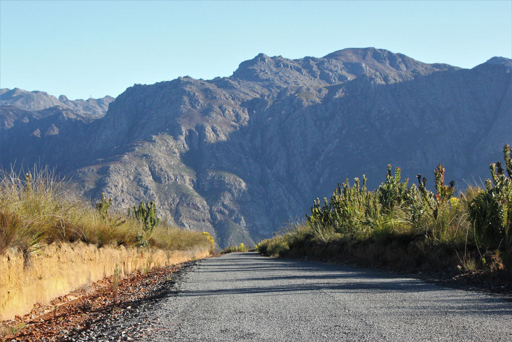
The hike began at the MCSA’s Du Toit’s Hut just off the N1 highway. From here we made our way to the Fizantakraal road, which leads through private property towards the Agtertafelberg Hut.
After a few hours trudging along the road, we turned off very near the Agtertafelberg Hut heading east towards what is known as Plum Pudding Ridge. Soon we were completely off any paths and fortunate to be with someone who knew the way.
 Heading up Plum Pudding Ridge from Agtertafelberg Hut.
Our route essentially followed the spine of the ridge with some moderate exposure, made worse only by my heavy pack and a very slippery rock section. We stopped at what turned out to be a perfect lunch spot.
 Mountains are big; humans are small.
After just over a kilometre of vertical ascent, at 1480m, we came to a rocky outcrop with a magnificent view of towering rock edifices and couloirs. It is difficult to capture the scale and grandeur of the valley with words or photos.
 Gigantic, sheer-sided cathedrals of rock.
After a satisfying lunch we continued climbing, the route becoming somewhat gentler until we topped onto the grassy vlaktes just over 1 700 m. There had been some winter rain and the areas on top were marshy, so one had to be wary of sinking into the bog beneath the yellow vlei grass.

Although one can camp anywhere, we decided on a flattish grassy area with crisp water nearby. There are several smaller peaks to explore if there is still gas in the legs.
 5-star campsite.
Day 2 (12.5 km)
The night had been cold — certainly the coldest I have ever experienced in a tent. We woke up to frozen ponds, icy bananas that I’d left outside, and frost covering the tent.
 Frosty morning.
 The evening was a bit too cold for the bananas.
From our campsite we traversed northeast toward a small saddle near the summit, then turned east, giving us both sunshine and amazing views over the Worcester valley and the Hex River Mountains.

From here we dropped our packs and climbed (precariously with snow and ice around) to the summit. There are a few masts and damaged metal items at the top, as well as two trig beacons — one of which is Trig 8 at 1994.7m.
 Breathtaking views from the summit.
The view here is arguably unparalleled anywhere in the province — a 360° panorama of peaks, valleys, and towns, topped off with a dramatic view down Du Toit’s sheer northern face to the N1 highway below.
 Looking across the valley at the mountains on the other side of the N1.
The route down followed what I understand is ‘Ridges’ and skirts the spine and southern slopes of the ridge visible from the N1. There is some exposure near the top and on a rocky scramble further down, but generally the route is strenuous rather than technical.
 Starting our descent.
There is evidence of a path in parts, which becomes clearer near the bottom on the Elands Pad property, where the path joins a gravel track before meeting the Fizantakraal tar road.
 Grand views along the descent.
As far as weekend hikes go, it doesn’t get more grand and epic than this!
There are unusually few streams in this valley. There is one river to access water from on the Fizantakraal road but very little otherwise, except in the vlaktes near the summit. These could be dry in summer, so one should carry plenty of water – making a challenging outing even more difficult. The hike should only be attempted by fit persons who are comfortable carrying a backpack. Additionally, it should only be done with someone who has done the route before and knows the way.
Permits
Permits from CapeNature are required (as most of the hike is in the Hawequas Mountain Catchment Area) as well as permission from the private farm owner to traverse their land.