Rim of Africa | Traverse 3
Beauty: 5/5
Difficulty (fitness): 10+/10 (Extremely tough, both physically and mentally)
Technical Rating: Mostly off-trail hiking, involving dense fynbos, uneven rocky terrain, and steep ascents and descents.
Duration: 7 Days
Day 1
Traverse 3 begins unusually for the Rim — with a descent. From neat rows of orchards we drop below the plateau into a forgotten valley carved by rivers that still run strong. The day’s walking is short enough to allow time to linger beside one of the Cape Mountains’ finest rock pools and waterfalls, where three streams converge on their journey to the Olifants River below.
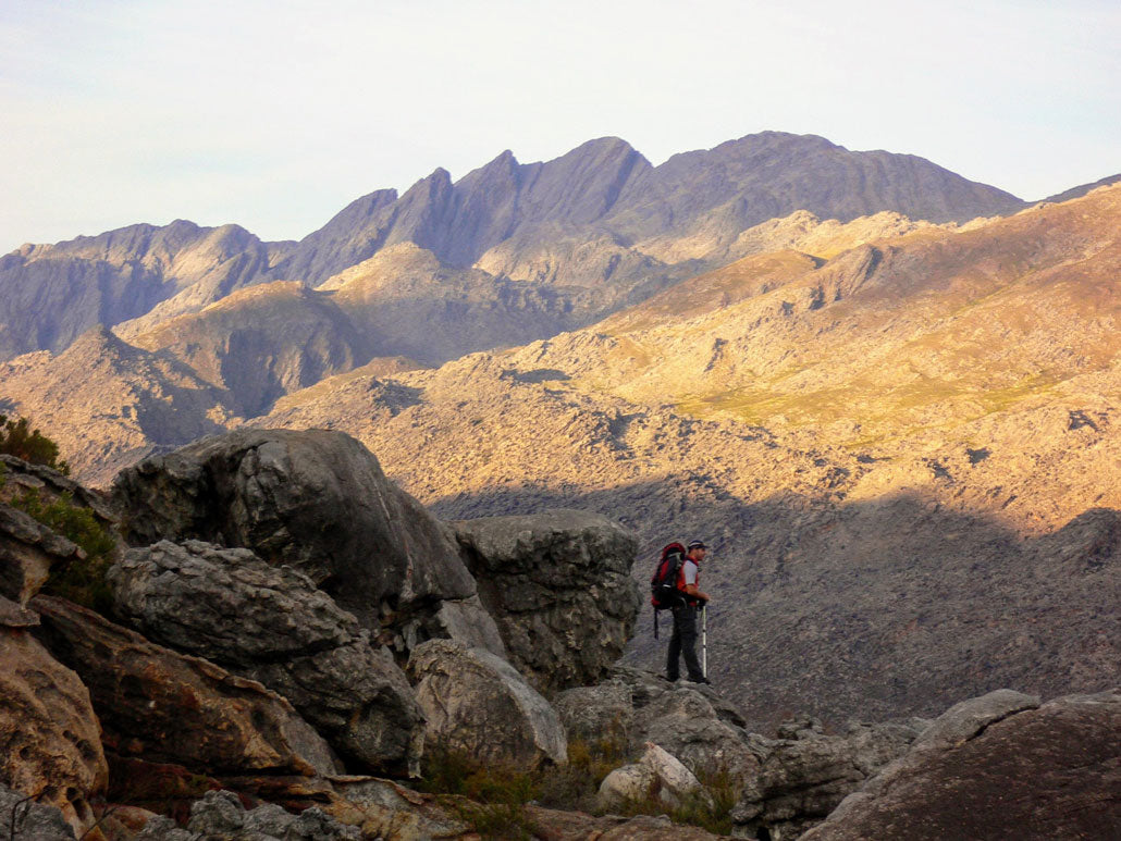
 Passing magnificent waterfalls and rockpools on Traverse 3. Photo credit: Bob Baigrie
Day 2
The second day starts short and steep, climbing the opposite edge of the valley. From the ridge we glimpse the winding river below before descending to a shaded spot beside a cool stream for lunch. The water flows over smooth, white sandstone — a perfect place to rest until the heat subsides. Later, in the soft afternoon light, we begin the long ascent up a north-facing slope, quickly gaining height and panoramic views over the mountain ranges stretching to the horizon. Camp is among scattered boulders beside a small, high stream under a vast sky of stars.
 Gaining perspective. Photo credit: Rim of Africa
Day 3
Today’s route crosses the wide crest of the Skurweberge — the Rough Mountains. No paths exist here, and there’s little sign that anyone has passed before. This is the undiscovered Cederberg, complete with its own natural “Maltese Cross” and perfectly balanced boulders. Despite its rugged name, the terrain allows surprisingly easy passage along flat-bottomed corridors where small streams flow between towering rock walls. The day ends at another idyllic camp with pools and waterfalls — essential features of any Rim campsite.
 A welcome respite. Photo credit: Bob Baigrie
Day 4
A steep descent takes us from the Skurweberge down to the farmlands below. We follow the base of the towering Witzenberg wall southwards through a wide, open valley. At midday we cross the Olifants River, resting in the shade beneath small cliffs before continuing across plains of low fynbos cut by narrow streams. That evening we relax among tall trees and soft lawns beside a tranquil lake — a brief taste of comfort between stretches of wild mountain terrain.
 Dramatic rock-strewn landscapes. Photo credit: Rim of Africa
Day 5
Shaded by pine trees, we start the day with a gentle, winding climb out of the valley. A jeep track soon leads us to the top of a ridge with sweeping views west toward Tulbagh and Table Mountain, and east across the Agter Witzenberg Valley we’ve just left. From the ridge we descend to a farm dam for a refreshing swim before following the edge of farmland until it becomes wild again. Our camp lies beside a tumbling mountain stream flowing toward the Ceres Dam — a peaceful end to a long day.
 Walking the high line. Photo credit: Galeo Saintz
Day 6
Day Six is long and demanding, with stretches of thick fynbos and difficult bushwhacking. The morning begins pleasantly with tea beside a small stream, but soon we must navigate around the Ceres Dam. When water levels are low, we can follow the shore; when high, we climb steeply around the valley’s edge. An old maintenance track beneath power lines offers partial relief from the overgrown proteas. The effort is rewarded by a late-afternoon descent to a flat, shaded campsite beside a quiet stream and deep, clear rock pool — one of the most magical on the Rim.
 Unique rock formations make for fascinating scenery. Photo credit: Ivan Groenhof
Day 7
A short morning walk follows the dam access road into Ceres — whose twinkling lights were visible the night before. Before re-entering civilisation, a narrow footpath leads through a boulder-strewn fynbos plateau and down a small stream valley to the edge of town. A hearty breakfast at the Zipline Coffee Shop marks the end of this rugged and beautiful mountain journey.
A Note on the Difficulty of Rim of Africa
Hiking South Africa’s difficulty scale rates the Amatola Trail as a 10/10. Most sections of the Rim of Africa are significantly tougher and more technical than that. The Rim is not a marked “trail” but a true mountain traverse, demanding advanced navigation skills, endurance, and respect for the terrain. Conditions and difficulty can vary each year based on weather, route choices, and vegetation growth.
For more information on the Rim of Africa hike, visit rimofafrica.co.za.